Our History
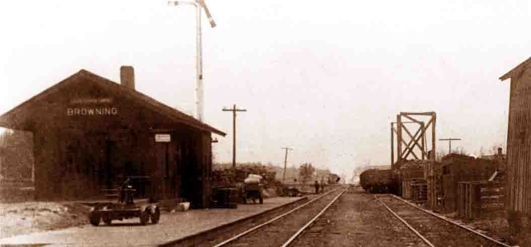
The history of the land where Camp Emmanuel sits starts just after the Civil War with the introduction of the railroad to the area around Browning, Illinois. Railroads had been critical to both sides in the Civil War, but following the war, new growth exploded in Illinois as Chicago started on its way to being the freight capital of the United States. Rail passages between larger cities were common, but new granger ("farmer") rail lines were quickly developed to move goods into cities, especially grain. Initially, railroads took advantage of small farms (like those in Browning) by charging large fees even for short transports, until Illinois passed the Illinois Granger Laws that regulated the fares. With this change, the railroad grew even faster, and the Browning rail depot with it.
Browning, Illinois Rail Depot - Date Unknown
Rail Lines
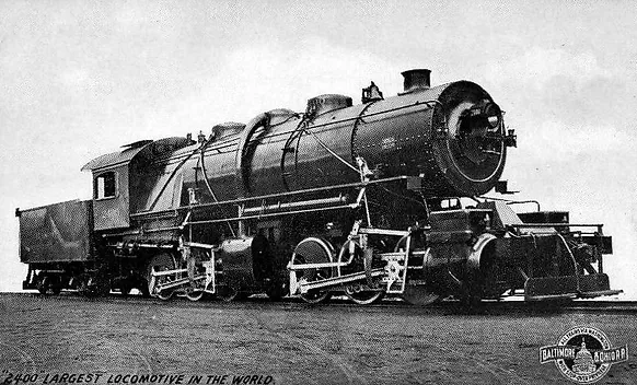
The rail lines at Browning were owned by the Chicago, Burlington, and Quincy Railroad (CB&Q) and went through Bader up into Fulton County, Illinois. The hill from Browning to Bader was steep - so steep that the CB&Q used the largest and most powerful locomotive at the time - Old Maude (a double 0-6-0 with twelve wheels) - to move freight up the hill. Northeast of Bader, the line ran through a low area known to locals as Mud Valley, aptly named due to the natural springs feeding a small creek. Some places around the area still retain that name - Mud Valley Church and Mud Valley Cemetery. Unlike the surrounding area, Mud Valley was usually too wet to be of real farming value, and according to county land records, this small valley changed hands more frequently than most areas of Schuyler County as a result.
Old Maude Locomotive
Water Problems
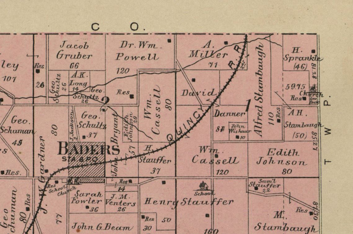
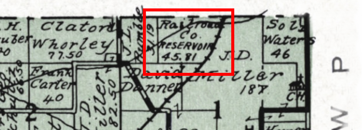
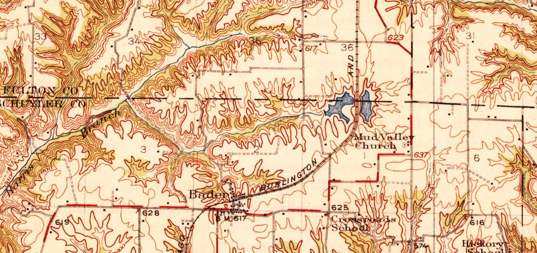
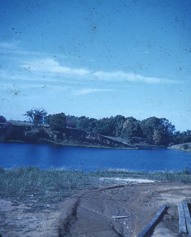
As steam engines became more powerful (and their routes longer), the CB&Q Railroad faced a new problem - water. In the early days, steam engines would need to stop as often as every 10 miles to take on water for the engine. For some rail companies - especially where stops on the line were infrequent - this problem was solved through the use of tender cars that could carry extra water. These cars were an added expense, and the company still had to find a reliable water source to fill the tender cars. Most rail companies faced a choice in the 1920s of whether to try to create a better water system along their tracks or try to acquire one of the brand new diesel engines. For most, that choice was soon made for them as first the Great Depression and then the Second World War kept their ever-aging steam engines in service. On granger lines like the one running through Bader, the CB&Q Railroad opted to build retention ponds in certain areas - specifically where small creeks intersected the existing rail lines. We don't know exactly when the railroad built the dam to make what we call Lake Emmanuel. Most of the maps from the turn of the century were plat maps focused on who owned which piece of land. A survey of maps dating back into the 1870's shows that the property was owned by various members (perhaps several generations) of the Miller family. "A. Miller" is listed on plat maps in 1913, but because this is not a topographical map, we don't know if the lake had been built at that time. The 1913 map only shows the railroad and a small creek running through the property. By 1920, the lake must have been built because the area was listed as "Railroad Co. Reservoir," but the map still doesn't show any body of water. "Mud Valley" was certainly conducive to creating a lake with its natural springs and creek, and the first map showing what would grow to be the 17-acre lake at Camp Emmanuel is a topographical map from 1926.
1913 Plat Map
End of the Line?
The lake shown in the 1926 topographical map is probably our best glimpse into the early formation of Lake Emmanuel. Initially, the lake was two small lakes extending on both sides of the railroad bed (just as they did in most water stops for steam engines). No maps created between 1926 and 1940 have been found of this area, but at some point between those years the railroad company changed their plans. In 1940, the property appears to be back in the hands of a man named "Dalton Miller" rather than the railroad company. We don't know why the railroad walked away from this property. At some point - we are not sure when - the railroad abandoned the line that went north of Bader in favor of a new line that went west of Bader. It could have been based on the terrain, which was very steep, or the advent of diesel engines on the line, or both. Most rail companies were looking at the much more efficient diesel engines in the late 1930's, especially after 1939 when a diesel demonstration engine went on a tour of America's rail lines and covered more than 80,000 miles across 35 states. Delays caused by material shortages in World War II helped keep steam engines around longer than they might have lasted on their own, but by 1955, nearly every major railroad company had more diesel than steam engines. Did the railroad move the line to lower the grade for their trains? Was there an economic benefit to moving the line just a few miles west? We don't know yet, but we'll keep digging.
1920 Plat Map
Doctors
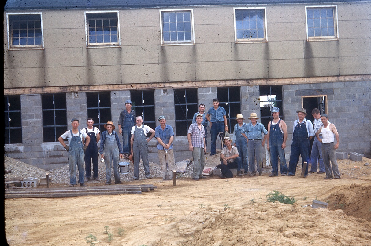
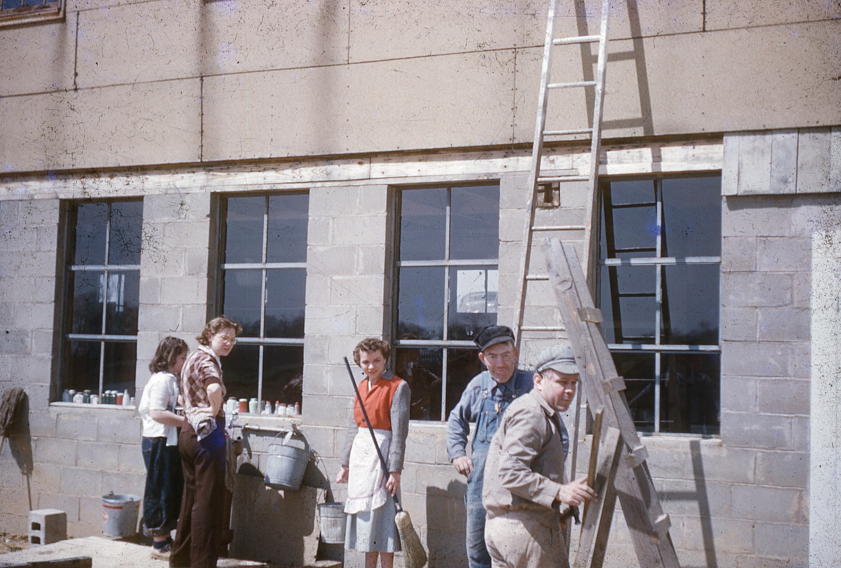
After the railroad decided to move on, three doctors purchased the lake and grounds from the CB&Q Railroad and constructed cabins along the dam. You can still see these cabins at Camp Emmanuel - we refer to them as the housekeeping cabins. Some time around early 1947, the doctors decided to donate the property to the Southern District of the Illinois Church of the Brethren. The terms of the agreement with these three doctors stipulated that they still have access to the grounds, and there are still friends of Camp Emmanuel who have memories of the doctors or their wives sitting outside the cabins. Research into this part of our history is ongoing - we are still checking on deeds and property records to find out more about the purchase and donation of the grounds for the formation of Camp Emmanuel. Camp Emmanuel was dedicated in 1947, with some sources saying that the first camps were held in tents in the summer of 1948. That same summer (1948), a work camp of around 50 volunteers officially broke ground on what we know as the main lodge foundations.
1926 Topographical Map
Moving from Camp to Camp
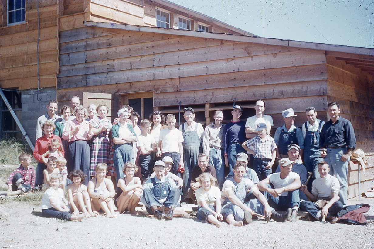
While the doctors' cabins were the first buildings on the property, plans were soon hatched to acquire more from Camp Ellis, an army base which served as both training grounds and a German prisoner of war camp near Ipava, Illinois. Encompassing more than 15,000 acres, more than 30,000 U.S. soldiers were trained at Camp Ellis, and more than 5,000 prisoners spent time there before the end of World War II. In October 1945, the camp and its more than 2,200 buildings were declared to be surplus, and the camp was transferred from the federal government to the Illinois National Guard. Over the next few years, the Camp Ellis property was chopped up and (mostly) sold back to the same farmers from whom the land had been taken (via eminent domain). This meant that the 75 miles of roads, 70+ mess halls, and remaining buildings not used by the Illinois National Guard were destined to be torn down or purchased and moved. Camp Emmanuel took advantage of this situation, sending a delegation of several men in early 1949 to inspect and purchase a few of the remaining buildings. Two army barracks - both from the prisoner of war camp - were purchased, moved, and reconstructed on Camp Emmaneul grounds. Six smaller cabins were later moved in sections in the spring of 1950. Original German writing can still be seen in the main lodge. The buildings at Camp Emmanuel are some of the few surviving remnants of one of the largest army training camps of WWII.
Breaking Ground on Main Lodge - 1948
Doctor's Cabin at South Camp - Winter 1948
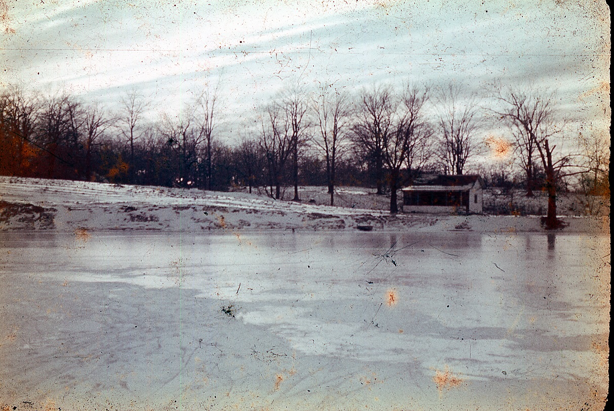
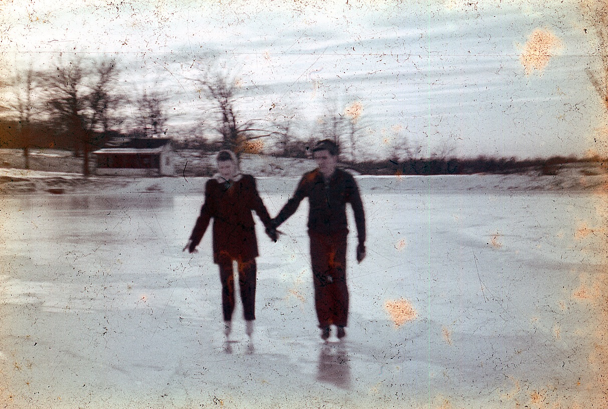
Skating on Completely Frozen Lake Emmanuel - Winter 1948
Camp Emmanuel Delegation at Camp Ellis - 1949: Mr. Chaurgo, Mr. Whitmore and Mr. Rhoades.
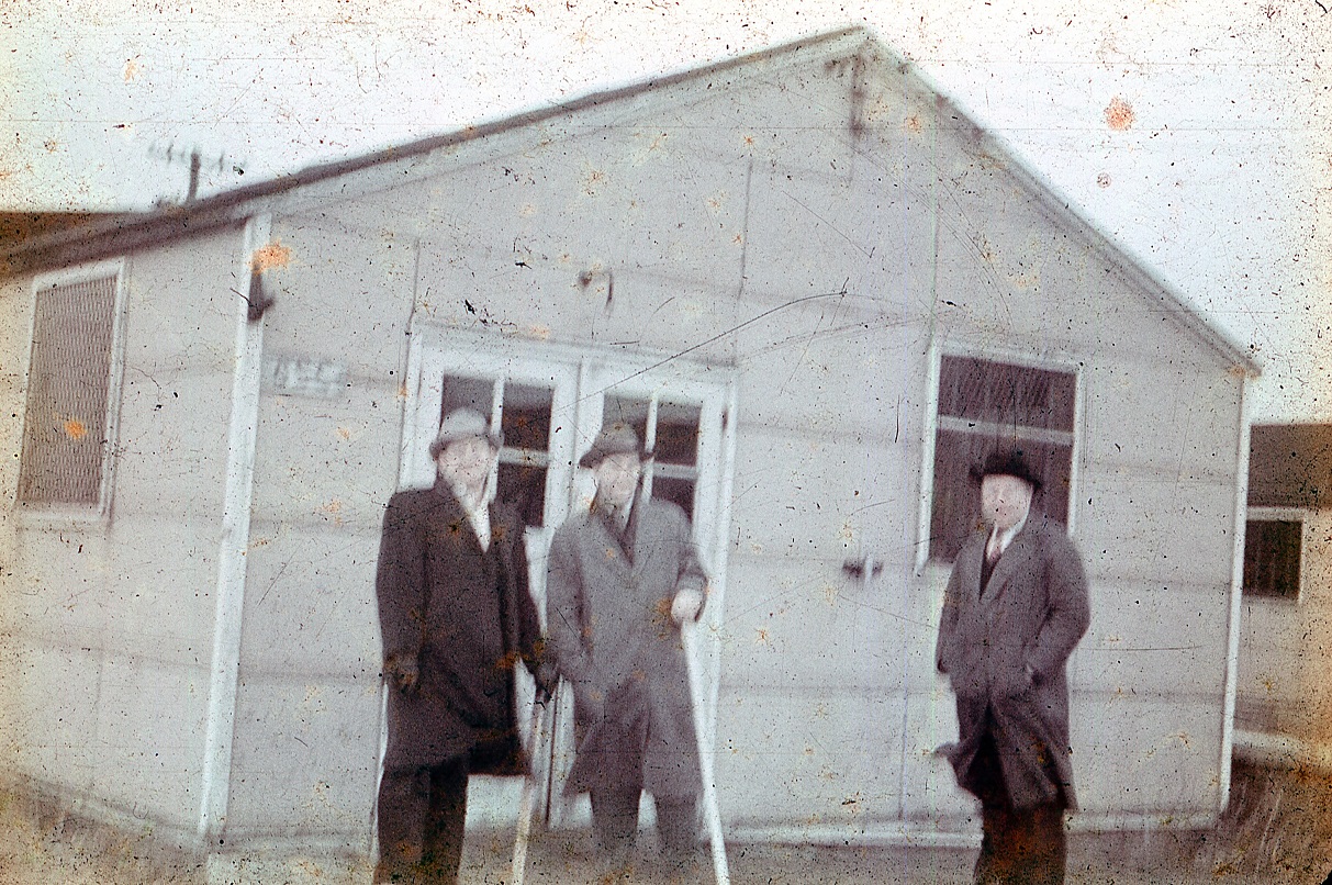
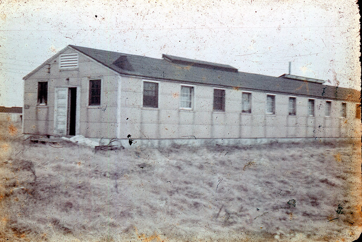
POW Barracks at Camp Ellis Before Being Moved to Camp Emmanuel to Become the Chapel - 1949
Inspecting the POW Barracks Before Purchasing - 1949
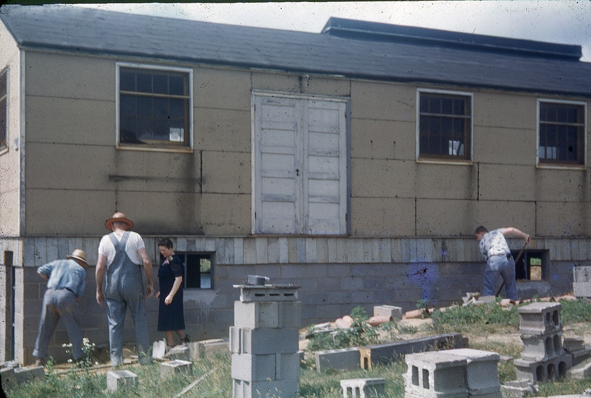
Ready to Place the Chapel on the Basement (Dining Hall) Foundation Built in 1948
Moving Day - 1949

Laying the Concrete for the Basement (Dining Hall) Floor after Moving the Chapel into Position
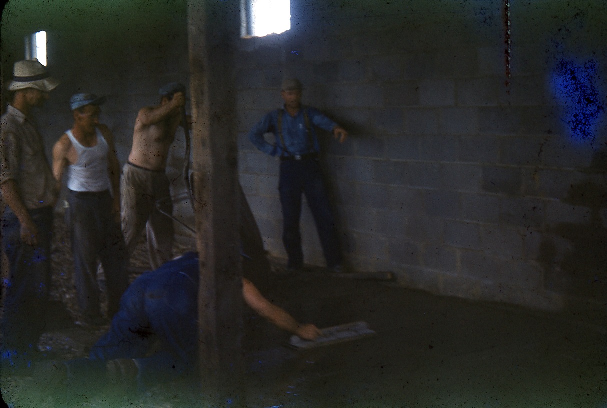
The Volunteers Who Poured the Basement (Dining Hall) Floor
"Getting ready for the first camp - 1949"
(Caption found on original slide)
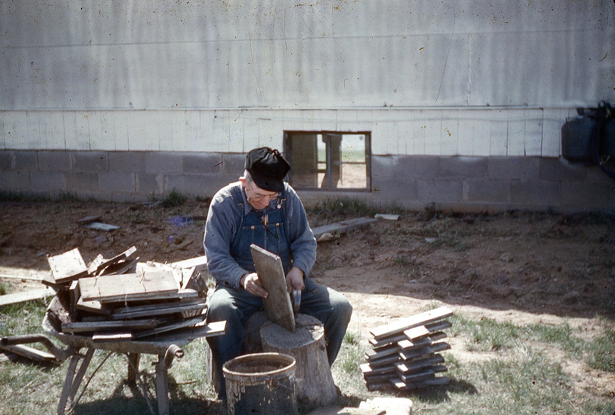
Volunteer Noah Walters Before the First Camp - 1949
Preparing for Campers - 1949
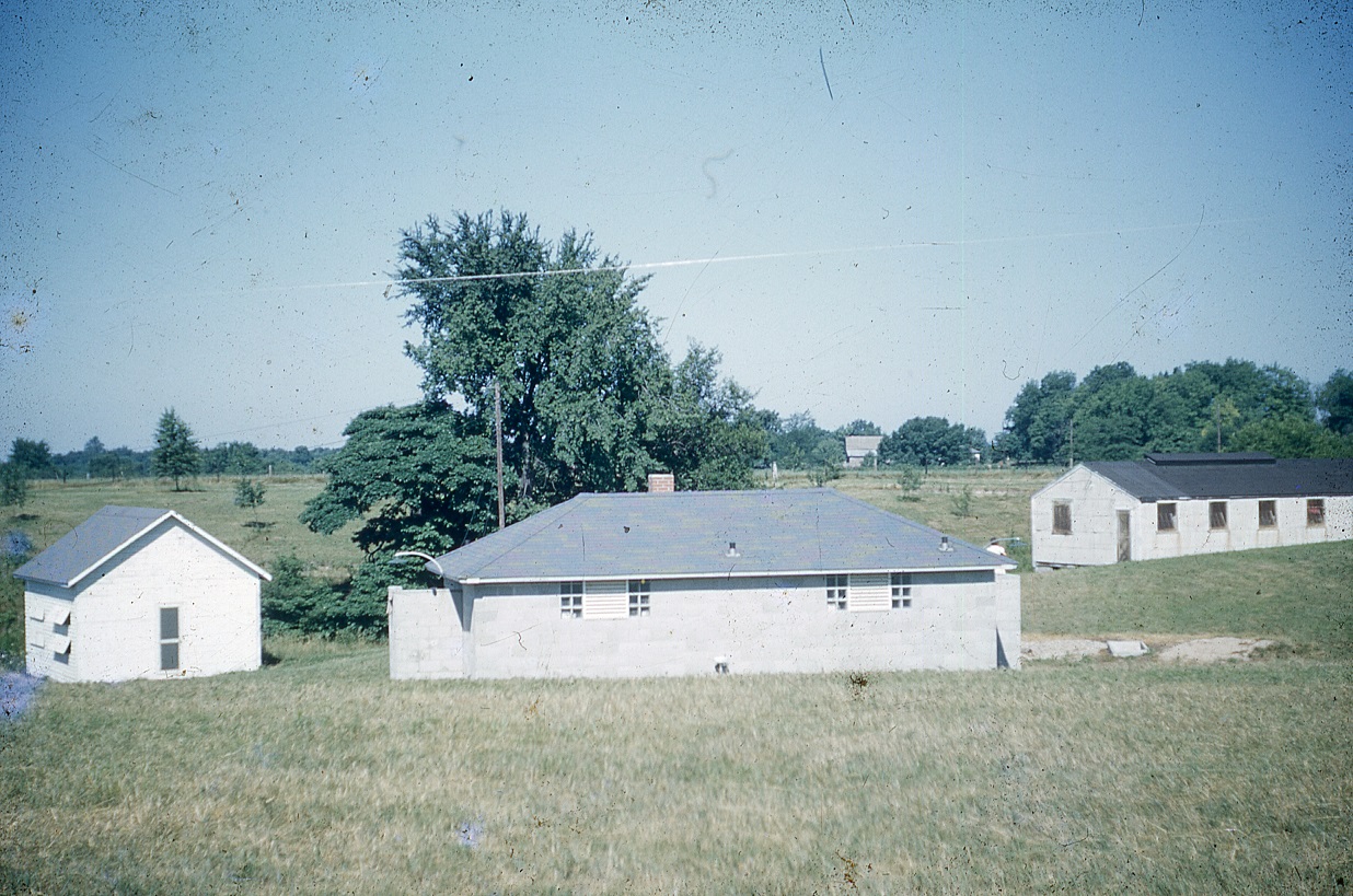
Camp in 1953 - Cook's Cabin (Maple), Bath House, and Girls Dormitory
Volunteers from the Cerro Gordo Church of the Brethren came to camp to put siding on the new porch in 1954.
Copyright ©
Camp Emmanuel Camp Board
Looking to make a contribution? Click below to donate to Camp Emmanuel securely via Paypal.